CCRP South Beach & Area
Objective: Prioritize execution of South Area Preferred Concept Plan from the Chambers Creek Regional Park Master Site Plan.
Background
Chambers Creek Regional Park (CCRP) is a Pierce County park primarily located in University Place. Below you will find a map that breaks the park into different sections…
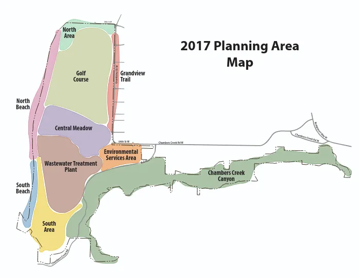
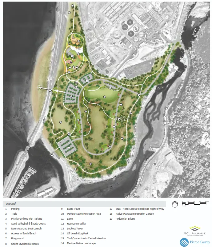
Our coalition wants to draw attention to South Beach and South Area, which currently do not have a clear way to be accessed by the public. This South Area could provide access to Chambers Bay, which delineates the University Place shoreline from the south. In 2017, the CCRP Master Site Plan was updated to provide the following preferred concept plan for the South Area, but so far we haven’t seen it executed yet:
Proposal
The UP Shoreline Public Access Coalition proposes that Pierce County and the city of University Place prioritize execution of the South Area Preferred Concept Plan from the Chambers Creek Regional Park Master Site Plan. We are happy with the existing plan, but disappointed that the public still hasn’t seen progress as we approach 10 years out.
Our coalition is separately tracking progress of the Pierce County Chambers Bay Estuary Restoration project, which could act as a catalyst for South Area public access. This estuary restoration will involve dam removal, vehicle bridge relocation, and riparian restoration. Specifically the South Area trail connections and non-motorized boat launch should be considered during the estuary restoration to avoid duplicated efforts and development stressors on the shoreline.
Current Status
Our coalition will be tracking progress of the Chambers Bay Estuary Restoration and a potential new iteration of the CCRP Master Site Plan in 2027. We hope to encourage city and county stakeholders to include parts of the South Area Preferred Concept Plan as part of the estuary restoration, with top priority for our coalition being trail connections and the non-motorized boat launch.
Updates
2026-05-09
Proposal published.